
Trails & Hiking

Filters for Trails & Hiking
Difficulty
Time needed
Good for
Cost
Area
Featured trails & hiking
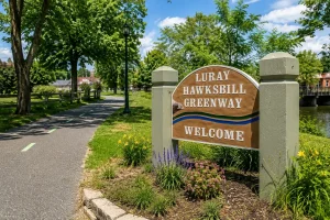
More trails & hiking
Cedar Run–Whiteoak Circuit
An 8.1-mile, very strenuous waterfall circuit with nearly 2,800 feet of gain — widely considered the best waterfall hike in the park, and one of the hardest.
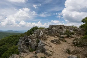
Hawksbill Summit Trail
A 1.7-mile moderate hike to the highest point in Shenandoah National Park.
 View Details
Kennedy Peak
A free 6.8-mile round trip in the George Washington National Forest to a stone observation tower looking straight down on Page Valley.
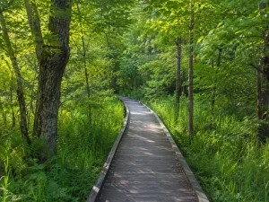
Limberlost Trail
A 1.3-mile circuit rated Easiest by the National Park Service.
 View Details
Marys Rock from Panorama
A 3.7-mile round trip to a wide view over Page Valley — the closest major Skyline Drive trailhead to Luray.
Rose River Falls Loop
A 4.0-mile loop past a 67-foot waterfall — a real circuit with far less crowding than nearby Dark Hollow Falls.
Shenandoah River State Park
A 1,619-acre Virginia state park with 25 miles of trails, river access, and genuine accessibility features — the most accessible outdoor destination within an hour of Luray.
Whiteoak Canyon — Lower Falls
An easy 2.0-mile round trip to a swimming-hole waterfall — the approachable side of Whiteoak Canyon, best visited on a weekday or in fall.
Whiteoak Canyon — Upper Falls
A moderate 4.6-mile round trip to Whiteoak Canyon's 86-foot upper falls — the taller, more demanding half of the canyon.
Coming for more than a day? Find a cabin or vacation rental close to what you want to see.